Site Location Map ( Click here to see all sites within 10 miles of this location )
Nearest Petrol Stations (these are shown on the map above)
Total, Bakewell Motors - 4.86 miles from site
Jet, Parkview FS - 4.98 miles from site
Show nearest:  National Trust National Trust  English Heritage English Heritage  Fuel Stations Fuel Stations  Good Pub Guide Pubs Good Pub Guide Pubs
Directions
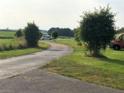
A515, Ashbourne to Buxton turn right after Bull i`th` Thorn pub, continue for approx 1 mile down Moor Lane, then turn right at left hand bend where the property is signposted. Approaching from Buxton on A515, turn left after Duke of York pub, take a left at junction and continue to bottom of road and turn right on left hand bend, property signposted. From Bakewell take B5055 at roundabout, turn right after Bolehill farm, continue for approx 3 miles, turn left at crossroads, go through Flagg village, turn left at bus shelter, and continue on, property signposted
Nearby Attractions
Flagg is a small rural village with 2 pubs and tearooms within walking distance.
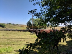
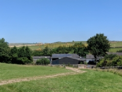
Just a stones throw away from the Limestone way-footpath, which cuts through some of our farmland. The Tissington, Monsal Head and High Peak trails are nearby for walkers & bicycle enthusiasts.
There are many places to visit and lots of activities to suit everyone including the famous Chatsworth House, Haddon Hall (where Jayne Eyre was filmed), The Heights of Abraham, the Caves at Castleton, Carsington Reservoir, balloon rides, garden centres, fishing, bird watching, horse riding, shopping villages, local weekly market stalls including a livestock market in Bakewell on Mondays, monthly local farm produce markets, agricultural shows, well dressing and carnivals and much much more!!
|



 National Trust
 English Heritage
 Fuel Stations
  Good Pub Guide Pubs
