Advertisement
Map and location details of Pool Bank Farm Certificated Location
|
|
|
|
Pool Bank Farm Certificated Location
Keepers Lodge
Pool Bank Farm
Pool Bank New Road
Otley
West Yorkshire (Browse area)
LS21 1EU
Visit their website Check Digital TV coverage See Weather Forecast
   
|

Pitches: 5 CAMC Members Only
Open: 01/01/2025 to 31/12/2025
Rating: 
|
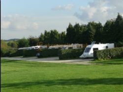
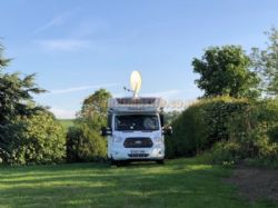
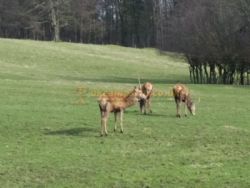
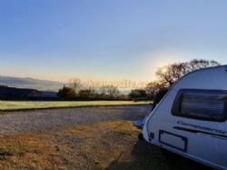
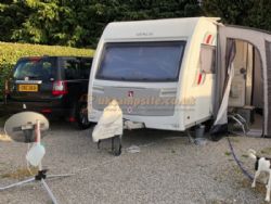
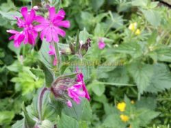
Photos (9)
|
 No Tents No Tents |
 Caravan Pitches Caravan Pitches |
 Motorhome Pitches Motorhome Pitches |
 Small Campervans Small Campervans |
 No Glamping Units No Glamping Units |
 No Statics for Hire No Statics for Hire |
 No Statics for Sale No Statics for Sale |
 No Seasonal Pitches No Seasonal Pitches |
 Electric Hookups Electric Hookups |
 Hardstanding Pitches Hardstanding Pitches |
 Fully Serviced Pitches Fully Serviced Pitches |
 Show Full Facilities Show Full Facilities |
| Who's it for |
 Adults Only Adults Only |
 Club Members Only Club Members Only |
 No Rallies No Rallies |
 Not Naturist Site Not Naturist Site |
 Dogs Welcome Dogs Welcome |
 No Dogs Allowed No Dogs Allowed |
 Groups Welcome Groups Welcome |
|
| Facilities |
 Toilet Facilities Toilet Facilities |
 No Showers No Showers |
 No Washing Up Area No Washing Up Area |
 No Bathroom No Bathroom |
 No Baby Changing No Baby Changing |
 No Laundry No Laundry |
 Drinking Water Drinking Water |
 Disabled Friendly Disabled Friendly |
 Chemical Disposal Chemical Disposal |
 Battery Charging Battery Charging |
 No Gas Exchange No Gas Exchange |
 Recycling Facilities Recycling Facilities |
 No Kitchen Facilities No Kitchen Facilities |
 No Freezer / Fridge No Freezer / Fridge |
 No Motorhome Point No Motorhome Point |
 No Wifi Access No Wifi Access |
 Shop <1 mile Shop <1 mile |
 Bar <1 mile Bar <1 mile |
 Restaurant or Cafe or Takeaway <1 mile Restaurant or Cafe or Takeaway <1 mile |
| Activities |
 No Playground No Playground |
 No TV Room No TV Room |
 No Games Room No Games Room |
 No Evening Ents No Evening Ents |
 Fishing 1 mile Fishing 1 mile |
 No Wild Swimming No Wild Swimming |
 No Indoor Pool No Indoor Pool |
 No Outdoor Pool No Outdoor Pool |
 No Horse Riding No Horse Riding |
 No Cycle Hire No Cycle Hire |
 No Golf No Golf |
 Tennis 1 mile Tennis 1 mile |
 No Beach No Beach |
 No Watersports No Watersports |
 No Boat Launch No Boat Launch |
| Other Features |
 No Sea Views No Sea Views |
 Not Working Farm Not Working Farm |
 No Campfires Allowed No Campfires Allowed |
 Open All Year Open All Year |
 No Waterside Pitches No Waterside Pitches |
 Public Transport On Site Public Transport On Site |
 Offroad Dog Walk On Site or Direct Access Offroad Dog Walk On Site or Direct Access |
 Electric Car Charging Point Electric Car Charging Point |
|
|
|
|
Site Location Map ( Click here to see all sites within 10 miles of this location )
Directions
From M1 heading North continue to A1M, exit at sign A659 OTLEY, continue to POOL turn left into A658, in approximately 1/2 mile.turn right into farm road at CL sign.
From A1 heading South, exit at sign for Harrogate / Airport, after Pool continue for approx 1/2 mile turn right into farm road at CL sign.
From M62 heading East, exit at M606 then exit to Bradford ring-road, exit at sign to Harrogate / Airport continue past airport to junction with A660 continue down hill for approx 400 yard turn in at first house into farm road.
Nearby Attractions
You can also explore The Dales and the Washburn valley a tributary of the Wharfe which offers some of best scenic walks and drives in the area and has been described as a mini Lake District with numerous footpaths and car parks around four reservoirs with fly fishing, and white water canoeing. Continuing up the Whafe Valley which is the principal route of the "Dales Way" footpath from Ilkley to Bowness is Ilkley, Addingham, Bolton Abbey with Strid wood including the pavilion cafe / restaurant, Burnsal, Grasington, Kettlwell. Other towns you must see are:- Settle, Malham, Patley Bridge, Inglton, and Harewood House and grounds plus bird garden etc, etc. all with their own unique attractions. Not forgetting the ancient city of York which is within easy striking distance.
Nearest English Heritage Locations (these are shown on the main map above)
Spofforth Castle - 8.37 miles from site Click here for details
St Marys Church - 15.75 miles from site Click here for details
Show nearest:  National Trust National Trust  English Heritage English Heritage  Fuel Stations Fuel Stations  Good Pub Guide Pubs Good Pub Guide Pubs
|
3846 Visitors online !
Free UKCampsite.co.uk Window Sticker - Recommend to Friend - Add a Missing Campsite
[Message Forums]
[Caravan Sites & Camping]
[Company Listings]
[Features / Advice]
[Virtual Brochure]
[Special Offers]
[Reception]
[Competitions]
[Caravans & Motorhomes For Sale]
[Event Diary]
[Contact Us]
[Tent Reviews]


Please note we are not responsible for the content of external sites & any reviews represent the author's personal view only. Please report any error here. You may view our privacy and cookie policy and terms and conditions here. All copyrights & other intellectual property rights in the design and content of this web site are reserved to the UKCampsite.co.uk © 1999 - 2025 |

Advertisement
|
|
Advertisement
|


 National Trust
 English Heritage
  Fuel Stations
 Good Pub Guide Pubs
